Coastal mapping is a crucial aspect of marine research, navigation, and resource management. It involves the detailed surveying and charting of coastal areas, including the seabed, shoreline, and water column. One of the key tools in this process is the marker buoy. As a marker buoy supplier, I have witnessed firsthand the significant role these buoys play in coastal mapping.
Understanding Coastal Mapping
Coastal mapping is not a simple task. It requires the collection of a vast amount of data, including bathymetry (the measurement of water depth), topography (the shape of the land), and the location of various features such as reefs, shoals, and underwater structures. This data is then used to create accurate maps that are essential for safe navigation, environmental monitoring, and the development of coastal infrastructure.
The process of coastal mapping typically involves the use of various techniques and technologies, such as sonar, LiDAR (Light Detection and Ranging), and GPS (Global Positioning System). However, marker buoys also play a vital role in this process, providing a physical reference point that can be used to calibrate and validate the data collected by these other methods.
The Role of Marker Buoys in Coastal Mapping
1. Providing Fixed Reference Points
One of the primary roles of marker buoys in coastal mapping is to provide fixed reference points. These buoys are strategically placed in the coastal area being mapped and are accurately located using GPS technology. By using these buoys as reference points, surveyors can ensure that the data they collect is accurately georeferenced, meaning that it can be precisely located on a map.
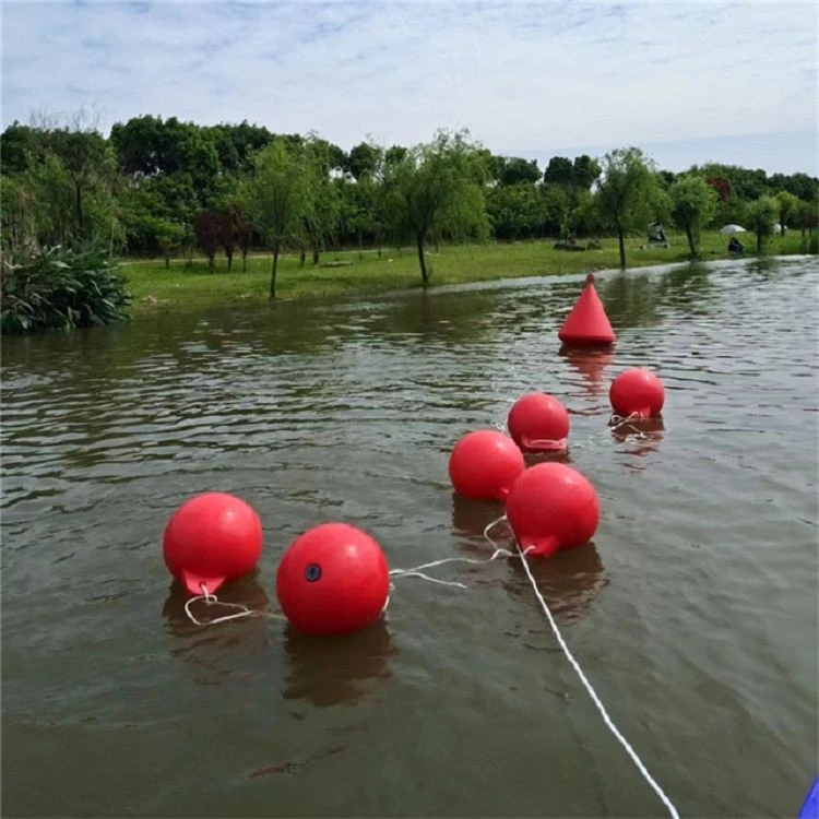
For example, when using sonar to map the seabed, the position of the sonar equipment needs to be accurately known in order to calculate the depth of the water and the location of underwater features. Marker buoys provide a stable and reliable reference point that can be used to determine the position of the sonar equipment, ensuring that the data collected is accurate and reliable.
2. Aiding in Navigation
Marker buoys also play an important role in navigation during the coastal mapping process. They are used to mark the boundaries of the survey area, as well as the location of hazards such as reefs and shoals. This helps the survey vessels to navigate safely and efficiently within the survey area, reducing the risk of accidents and ensuring that the mapping process can be carried out smoothly.
In addition, marker buoys can be used to guide the survey vessels along specific survey lines. By following these lines, the surveyors can ensure that they cover the entire survey area in a systematic and comprehensive manner, collecting data from all parts of the area being mapped.
3. Monitoring Environmental Conditions
Another important role of marker buoys in coastal mapping is to monitor environmental conditions. These buoys can be equipped with a variety of sensors, such as temperature, salinity, and water level sensors, which can be used to collect data on the environmental conditions in the coastal area.
This data is important for understanding the physical and chemical properties of the water, as well as the impact of human activities on the coastal environment. It can also be used to validate the data collected by other environmental monitoring methods, such as satellite remote sensing and in-situ sampling.
4. Validating Mapping Data
Marker buoys can also be used to validate the mapping data collected by other methods. For example, after the seabed has been mapped using sonar, the data can be compared with the actual location of the marker buoys on the seabed. If there are any discrepancies between the data and the location of the buoys, it may indicate that there is an error in the mapping data, which can then be corrected.
In addition, marker buoys can be used to verify the accuracy of the bathymetric data collected by sonar. By measuring the water depth at the location of the buoys using a different method, such as a lead line or a depth sounder, the surveyors can compare the results with the sonar data and ensure that it is accurate.
Types of Marker Buoys Used in Coastal Mapping
As a marker buoy supplier, I offer a wide range of marker buoys that are suitable for use in coastal mapping. Some of the most common types of marker buoys used in this application include:
1. Marker Buoys with Both End Eyes
These buoys are designed with eyes at both ends, which makes them easy to attach to mooring lines and other equipment. They are typically made of high-quality materials, such as polyethylene or fiberglass, which are durable and resistant to corrosion.
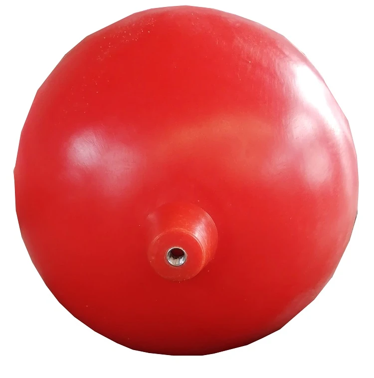
2. Pu Foamed Marker Buoys
Pu foamed marker buoys are filled with polyurethane foam, which provides excellent buoyancy and makes them very stable in the water. They are also lightweight and easy to handle, making them ideal for use in coastal mapping applications.
3. PE Shell Marker Buoy
PE shell marker buoys are made of polyethylene, which is a strong and durable material that is resistant to UV radiation and chemicals. These buoys are typically used in areas where there is a high risk of damage, such as in areas with heavy boat traffic or in areas exposed to harsh environmental conditions.
Conclusion
In conclusion, marker buoys play a vital role in coastal mapping. They provide fixed reference points, aid in navigation, monitor environmental conditions, and validate mapping data. As a marker buoy supplier, I am committed to providing high-quality marker buoys that meet the needs of coastal mapping professionals.
If you are involved in coastal mapping and are looking for reliable and high-quality marker buoys, please do not hesitate to contact us. We would be happy to discuss your specific requirements and provide you with a customized solution that meets your needs.
References
- Smith, J. (2018). Coastal Mapping: Principles and Practice. London: Routledge.
- Johnson, M. (2019). The Role of Buoys in Marine Navigation and Mapping. Journal of Marine Science and Technology, 24(3), 256-263.
- Brown, A. (2020). Environmental Monitoring in Coastal Areas: The Use of Buoys and Sensors. Environmental Science and Pollution Research, 27(15), 18023-18032.